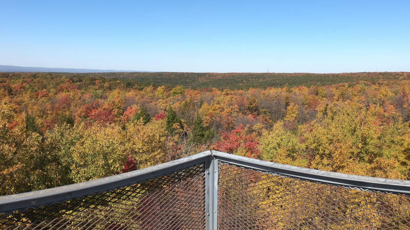
At 3,213 feet high, Mt. Davis is Pennsylvania’s highest point, sitting gently among three trail towns on the Great Allegheny Passage; Meyersdale, Rockwood, and Confluence. The summit, one of several high points on a 30-mile ridge, is encircled by a handful of hiking trails, and features a climbable fire tower that offers expansive views in all directions. Biking to the summit is the appeal of the annual Mt. Davis Challenge, a steep 56-mile gravel road adventure that starts in Confluence. A 581-acre natural area shows off rare sites, such as trees deformed by strong winds and winter ice storms, and small concentric stone rings caused by localized frost heaving. The mountain’s creeks drain into the Casselman River.
Mt. Davis is named for pioneer farmer, surveyor, and Civil War veteran John N. Davis, who once owned 26,000 acres of surrounding land, much of which is now part of Forbes State Forest.
Visitor Information
Mt. Davis is driveable from Confluence, Rockwood, or Meyersdale on a mix of paved and gravel roads. Hiking trails connect the high point with picnic areas, other viewpoints, and to the lower elevations of the natural area.