History
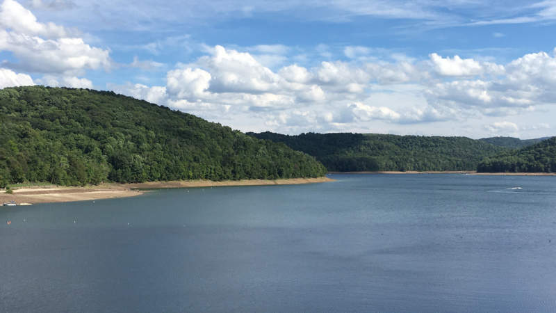
The 4.4-square mile Youghiogheny River Lake is a reservoir formed by the damming of the Youghiogheny River near Confluence. The dam is operated by the United States Army Corps of Engineers to facilitate flood control, alleviate pollution problems, and provide hydroelectric power to 8,000 homes. Access to the lake, which extends 16 miles into Maryland and spans the Mason & Dixon Line, sits about a mile off the Great Allegheny Passage and features a picnic area high above, perfect for a shady stop.
A popular location for recreation, Youghiogheny River Lake attracts numerous visitors each year. Boaters consider Youghiogheny River Lake to be the best power boating and water-skiing lake in southwestern Pennsylvania. Anglers explore the lake’s numerous coves and backwater areas which provide excellent fishing for panfish, walleye, and smallmouth bass. Between the dam and the Great Allegheny Passage is Youghiogheny Outflow Campground, with traditional pull-in and hiker-biker campsites.
Lake Creation
Youghiogheny River Lake was established in 1944 with the construction of the 184-foot high, 1,604-foot wide Youghiogheny Dam, an earthen structure and one of 16 such projects to control flooding in watersheds belonging to the Youghiogheny River, Monongahela River, and Ohio River. When water in the lake is extremely low, travelers and boaters can sometimes see a portion of the triple-arched sandstone Great Crossings Bridge, built in 1818 to carry the National Road across the Youghiogheny River.
Visitor Information
Parking above the lake and dam are at 497 Flanigan Road, Confluence, PA 15424. The picnic area is open dawn to dusk.